Hidden Gem Trails on the West Side of the Tetons (Most Tourists Never Find These)
Five lesser-known trails on the Idaho side of the Tetons — same mountains, a fraction of the crowds, and one view that inspired Thomas Moran's most famous painting.
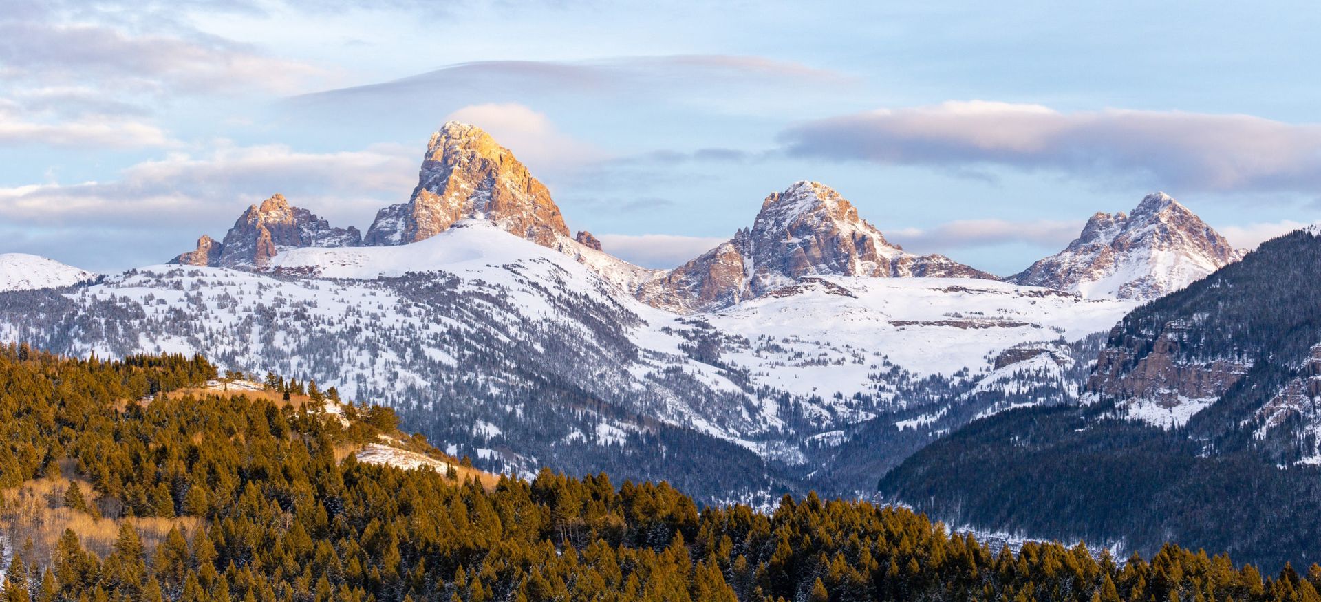
In the summer of 1872, painter Thomas Moran stood on the wind-scoured plateau of Table Mountain — on the Idaho side of the Tetons — and made a series of sketches that would become one of the most famous images in American landscape painting. His Grand Teton shows the mountain as he saw it from the west: a vertical wall of granite rising 7,000 feet from the valley floor, impossibly steep, lit in amber light.
That view is still there. You can stand in almost the same place Moran stood 150 years ago. The difference is that today, while thousands crowd the parking lots at Jenny Lake seven miles away, you'll likely share the Table Mountain summit with fewer than a dozen others.
This is the fundamental fact about the west side of the Tetons: it is one of the most spectacular landscapes in North America, and almost nobody goes there.
The east face — Grand Teton National Park, accessible from Jackson — gets around 3.5 million visitors a year. Paved trails. Timed entry parking. Shuttle buses every 15 minutes. The west side — the Idaho face, managed by Caribou-Targhee National Forest and the Jedidiah Smith Wilderness — gets a fraction of that traffic. Vault toilets and a bulletin board. Trails maintained on a schedule that leaves them raw and honest.
If you're staying in Teton Valley and want to actually see the mountains rather than the parking situation, this is where you go.
In This Guide
- 📍
Table Mountain — 11.4 mi · 3,800 ft gain · Strenuous — Stand where Thomas Moran painted the Grand Teton
- 🌬
Darby Canyon Wind Cave — 5.8 mi · 1,600 ft gain · Moderate — A geological phenomenon most visitors drive past
- 🏔
Alaska Basin — 14–19 mi · 2,800+ ft gain · Strenuous — Crown jewel of Idaho's backcountry, gateway to the Teton Crest
- 🌲
South Leigh Canyon — 3–8 mi · Easy to Moderate — 200-year-old old-growth forest, moose meadows, fall aspen color
- 🦌 Moose Creek — 6–10 mi · Moderate — The trail the guidebooks forgot, and the solitude you came here for
Before You Hit the Trail
- Land management. These trails are on Caribou-Targhee National Forest and Jedidiah Smith Wilderness land — not NPS. No entry fee, no timed-entry reservation system. Overnight camping requires a free wilderness permit, self-issued at the trailhead. Confirm conditions with the
Teton Basin Ranger District at (208) 354-2312.
- Season. Teton Canyon (Table Mountain, Alaska Basin) typically opens for day hiking by early to mid-July. Darby Canyon Wind Cave often by late June. South Leigh Canyon by mid-June. Always call the ranger district before you go — conditions change weekly. The
Caribou-Targhee National Forest posts updates online.
- Bears. Grizzly bears are well-established throughout this wilderness. Carry
bear spray on the hip — not in the pack — where you can draw it in two seconds. Make noise near running water.
- Navigation. No cell service in most of these canyons. Download offline maps on
Gaia GPS before leaving the house — not when you get to the trailhead.
- Parking. The Teton Canyon trailhead holds roughly 25 cars and fills by 8 AM on summer Saturdays. Arrive by 7 AM or camp at Teton Canyon Campground the night before.
1. Table Mountain — Stand Where Thomas Moran Stood
🗺
11.4 miles round trip · ⬆
3,800 ft elevation gain · 🏔
11,106 ft high point · ⚡
Strenuous
📍 Teton Canyon Campground, ~6 miles east of Driggs on Teton Canyon Road
View Table Mountain on AllTrails →
The trail begins gently. For the first three miles you're following the floor of Teton Canyon along North Fork Teton Creek — a wide, glacier-carved valley with walls rising steeply on both sides. Pikas call from talus slopes above. Wildflowers carpet the meadows in midsummer. You're not yet climbing and it already feels like you're somewhere important.
At mile 3, the trail forks. Left goes south toward Alaska Basin. Right — the North Fork trail — is yours. This is where the work begins.
The climbing is sustained for the next two miles, switchbacking through upper spruce and subalpine fir, the trees growing shorter and more wind-bent as you gain altitude. A false summit appears around 10,200 feet, convincing enough that some hikers turn back believing they've hit the top. Keep going.
The maintained trail eventually ends and you're navigating talus by cairns. Then you step onto the plateau and the world opens up.
The summit is a nearly flat, half-mile-wide platform at 11,106 feet on the Idaho-Wyoming state line. Teton Valley stretches below in farmland and river bends. And directly across — 13,775 feet of granite cliff — the face of the Grand Teton fills the sky at a distance that makes it look almost close enough to touch. The Cathedral Group, Mount Owen, Teewinot, the full sweep of it. This is what Moran saw. You're standing in one of the most historically significant viewpoints in American landscape art.
💡 What most people miss: The plateau is large enough to explore on foot. The southeast corner gives a different angle on Buck Mountain. Bring binoculars — on clear mornings, you can watch climbers on the Grand's east face.
⚠️ Weather window: Be off the summit by 1 PM. The plateau is completely exposed and afternoon thunderstorms build fast at this elevation. This is not a suggestion.
— — —
2. Darby Canyon Wind Cave — A Geological Phenomenon Most Visitors Drive Past
🗺
5.8 miles round trip · ⬆
1,600 ft elevation gain · ⚡
Moderate · 🐕 Dogs allowed
📍 End of Darby Canyon Road, south of Driggs via Highway 33 (signed turnoff)
View Darby Canyon Wind Cave on AllTrails →
The wind cave at the end of Darby Canyon is a karst feature — carved by water through limestone in the canyon's upper cliffs. The physics are straightforward: the cave connects underground to a large reservoir of cold air at higher elevation. In summer, the pressure differential causes it to exhale cold air outward. In winter, the process reverses and the cave breathes warm air out.
Standing at the cave entrance in August, the effect is startling. You've just climbed 1,600 feet in the summer heat. You step up to the opening in the cliff face and feel a steady 30-degree-cooler wind pushing back at you. The harder you worked to get there, the more remarkable it feels.
But there are actually two caves, and most visitors only find one.
The lower cave — easy to access, the one everyone photographs — is the wind cave proper. A hundred feet directly above it, reached by a short scramble on loose rock, is the ice cave. Inside, even in late July, ice formations persist on the walls and floor. Temperature near freezing. Requires a headlamp. In the way of genuine geological oddities, it's wonderful.
The trail itself earns its keep. It follows Darby Creek through a narrowing canyon, passing a multi-tiered waterfall (best in June and early July) before the limestone walls close in. Unlike the Teton Canyon trails, dogs are welcome here, which explains the local following.
💡 What most people miss: The ice cave, 100 feet above the main entrance on loose rock — bring a headlamp and watch your step. Ice formations persist well into summer, and the experience of descending from July heat into a near-freezing cave is something you'll describe to people for years.
— — —
3. Alaska Basin — The Crown Jewel of the Idaho Wilderness
🗺
14–19 miles round trip (best as a 2-night backpack) · ⬆
2,800 ft to basin; +1,000 ft to Hurricane Pass · ⚡
Strenuous
📍 Teton Canyon Campground — take the left fork at mile 3 (same start as Table Mountain)
Jedidiah Smith Wilderness Info → | Teton Crest Trail on AllTrails →
The Teton Crest Trail — the famous 35-mile ridgeline route — is accessed primarily from Grand Teton National Park. What most hikers don't know: some of the most spectacular terrain on the Crest is reachable from the Idaho side, and Alaska Basin is how you get there.
At the mile-3 fork, turn left (south) and climb through old-growth forest into an open alpine basin at roughly 9,800 feet. Glaciers carved this cirque; the peaks of the Teton crest ring it on three sides.
Battleground Lake sits at the center — jade-green from glacial sediment, reflecting surrounding peaks on calm mornings. The late-July wildflower display here is extraordinary: Indian paintbrush, lupine, columbine, and Pedicularis groenlandica (elephant's head — a deep pink wildflower shaped exactly like its name, trunk and all). Moose in the lower willows. Marmots on every rock. Mountain goats on the upper ridges if you scan carefully.
From the basin, the trail climbs to
Hurricane Pass at 10,372 feet. The approach involves what hikers call
the Sheep Steps — a steep series of rock slabs requiring careful, confident scrambling. Not technical, but it earns its name. From the pass, you're looking directly into the South Fork of Cascade Canyon, the other side of the Tetons. If you've hiked Cascade Canyon from Jenny Lake, standing here and looking back is disorienting in the best possible way.
💡 What most people miss: Sunset Lake — a quieter tarn a short walk east of Battleground Lake. The crowds (such as they are) concentrate at Battleground. Sunset Lake frequently has no one at it.
📋 Permit note: Alaska Basin is in the Jedidiah Smith Wilderness — free self-issue permit at the trailhead for overnight camping. Cross Hurricane Pass into Grand Teton NP for an overnight and NPS backcountry permit rules apply. Day hiking across the pass is fine.
— — —
4. South Leigh Canyon — Where the Old-Growth Forest Still Stands
🗺
3–8 miles (variable — turn around when you're ready) · ⬆
500–1,200 ft · ⚡
Easy to Moderate
📍 South Leigh Creek trailhead, north of Driggs off Highway 33
View South Leigh Creek on AllTrails →
South Leigh Canyon is the west-side trail for people who have stopped needing to summit something to feel like the hike counted.
The canyon runs north of Driggs, parallel to Teton Canyon but quieter. The first thing you notice when you enter it is the trees. Old-growth Douglas fir — some 200 years old or more — stand in the lower canyon with a scale and stillness that younger forests in the valley don't have. The understory is sparse; the canopy too dense for much light to penetrate. Walking through these sections feels cathedral-like in a way that isn't a cliché.
South Leigh Creek runs alongside the trail the entire way. American dippers — small gray birds that live exclusively along fast-moving streams, diving into the water to walk along the bottom — work the creek constantly. They're one of the stranger and more charming birds in the American West, and this canyon is excellent habitat. Osprey fish overhead. Woodpeckers work the snags.
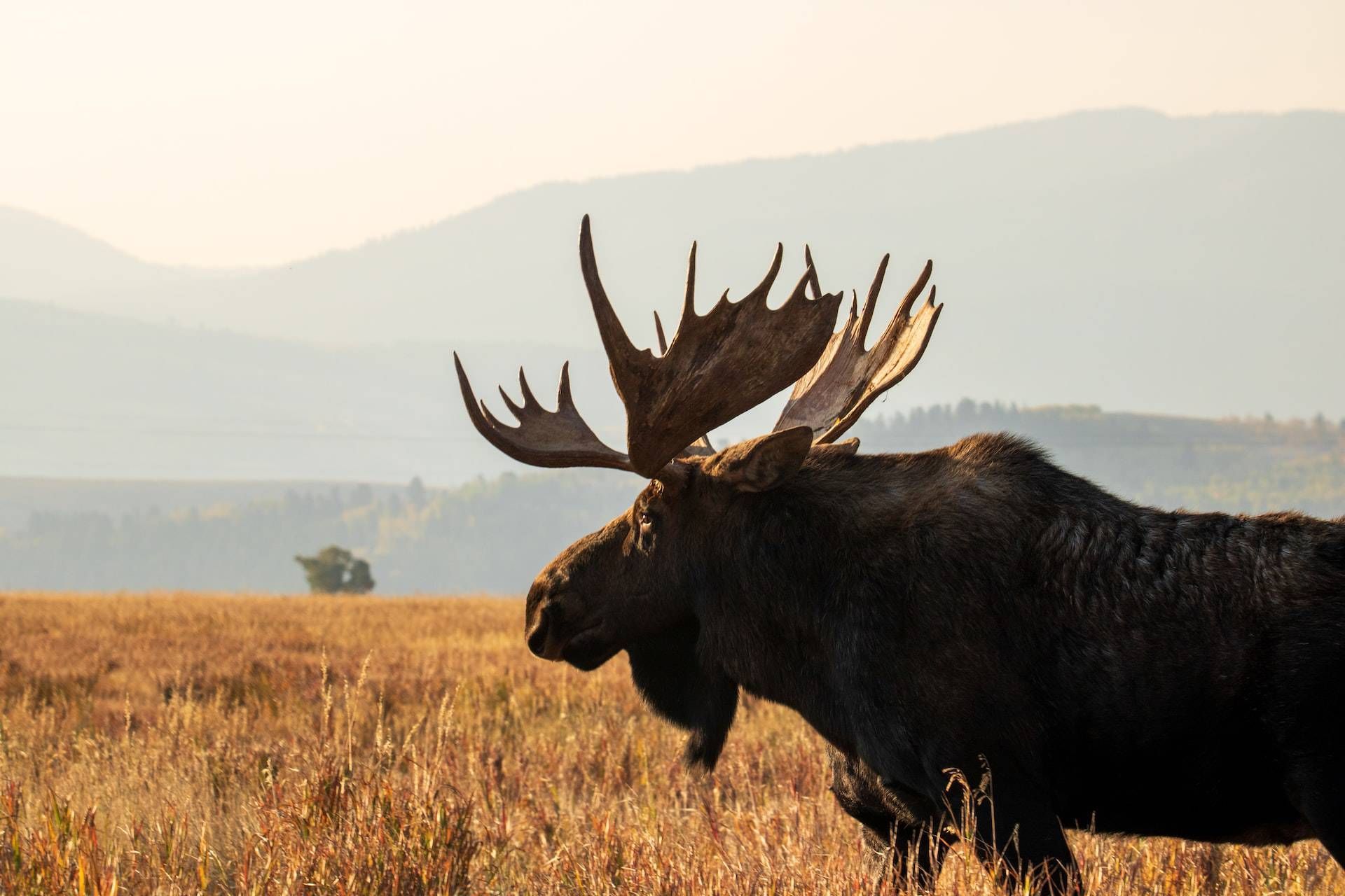
Around mile 2, the canyon opens briefly into a former beaver meadow. The dams have washed out but the flat, wet ground remains, and moose are frequently spotted here in morning and evening, feeding on the willows. Early-season hikers sometimes walk directly into moose without warning — be alert and make noise.
🍂 Come back in September: South Leigh Canyon's mixed forest turns gold and orange as the aspens peak, and because the canyon runs east-west, afternoon light comes directly in and makes the trees glow. This is one of the best fall color walks in the entire valley — and almost no one knows about it.
— — —
5. Moose Creek — The Trail the Guidebooks Forgot
🗺
6–10 miles round trip · ⬆
800–1,500 ft · ⚡
Moderate
📍 Moose Creek trailhead, north of Tetonia via Forest Road 015 (see navigation note)
There's a reason to name a trail Moose Creek, and it's that moose use it. The willows along the lower drainage hold moose reliably — morning hikes in July and August frequently produce sightings of cows with calves feeding in the creek, completely unbothered by a quiet passerby.
The trailhead sits north of Tetonia on a dirt road that's fine in dry conditions and properly bad when wet. GPS routing here is unreliable — download Gaia GPS offline maps before you leave and verify the approach. The first two miles cross private land under a Forest Service easement; stay on the trail.
Around mile 2, the canyon opens into a broad, flat-bottomed valley hidden entirely by the surrounding ridgelines until you're standing in it. Suddenly: a high meadow, peaks on three sides, wildflowers filling the foreground, and — almost certainly — no other people. Experienced hikers can gain the ridgeline above for a 180-degree view north past Tetonia to the Henry's Fork drainage.
🤫 Why this trail stays uncrowded: It doesn't go anywhere famous. No notable summit, no famous lake, no highlight reel photograph. What it offers instead is the quality of quietness that the American West used to provide more consistently — a place where you can spend a full day and see almost no one. That's increasingly rare and increasingly worth seeking out.
⚠️ Navigation note: Confirm current road condition with the Teton Basin Ranger District at (208) 354-2312 before driving in early season.The West Side Mindset
There's a pattern to all five of these trails: they require slightly more effort to find and access than east-side equivalents, and they return that effort with space, solitude, and the particular satisfaction of being somewhere people haven't completely figured out yet.
The Tetons are the same from both sides. What changes is the experience around the mountains — the quiet, the sense of scale, the feeling that the landscape is giving you something rather than processing you through it.
Spend a few days here, combine it with time in Grand Teton National Park for the lake walks and visitor center orientation, add a long day north to Yellowstone — and you'll leave with a relationship to these mountains that the east-side crowd rarely gets to have.
Browse vacation rentals in Driggs and Victor, Idaho →
Resources
- 🏕
Caribou-Targhee National Forest — trail conditions, wilderness permits, maps
- 📞
Teton Basin Ranger District — (208) 354-2312 — call before you go
- 🗺
AllTrails — trail maps and reviews for all five hikes above
- 📡
Gaia GPS — offline backcountry maps (essential for Moose Creek)
- 🐻
Bear Spray — NPS Guide — how to carry and use it
- ⛺
Teton Canyon Campground — book ahead for Saturday starts
- 🏔 Grand Teton National Park — for combining with west-side days